Introducing Piratas del Caribe y el mapa secreto
Introducing Piratas del Caribe y el mapa secreto
2 Minute Read
I teach a unit practicing the Present tense with “Piratas del Caribe y el mapa secreto”, by Mira Canyon & Carol Gaab.
It’s one of my students’ favorite books we’ve read, among Agentes secretos y el mural de Picasso, Robo en la noche, and La Llorona de Mazatlán.
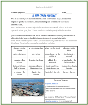
As a way to introduce the novel, I have students complete a “virtual field trip” of the Caribbean Sea, to get familiar with all of the countries located there!
It’s especially important for students to get familiar with the geography, since it’s mentioned right away in the first chapter, regarding the Spanish fleet hauling silver.
With this Caribbean Sea Digital Webquest, students research the following
(using the links provided):

How I Use this Webquest:
I give students a class period (45 minutes) to fill out the webquest.
The next day, I project their webquests on the SmartBoard, and have students come up to the board to explain 1 of the 8 places they researched.
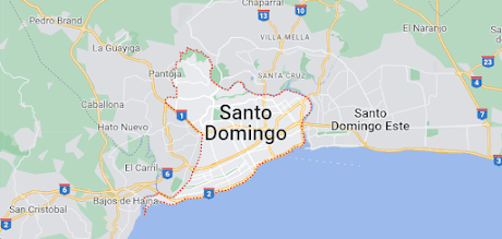
If you’re familiar with Google Maps and dropping the “yellow guy” around the 8 locations mentioned in the webquest, it can make it more realistic and interesting to show students these locations from Google Maps.


After this, students have more familiarity with where certain countries are in the Caribbean Sea, helping them understand the first chapter better. I then use the teacher’s guide a lot, for the rest of the book!
If you’re looking for No-Prep Digital Sub Plans, check out my blog post!
If you’re looking for ideas of how to teach another novel my students enjoy reading, check out my blog post, Introducing Robo en la noche!
With this Caribbean Sea Digital Webquest, students research the following
(using the links provided):
- Where the city or landmark is located
- What language is spoken there
- What’s the capital of the country?
- What is the country famous for?
- What is it?
- What’s the population?
- Other interesting facts
How I Use this Webquest:
I give students a class period (45 minutes) to fill out the webquest.
The next day, I project their webquests on the SmartBoard, and have students come up to the board to explain 1 of the 8 places they researched.
If you’re familiar with Google Maps and dropping the “yellow guy” around the 8 locations mentioned in the webquest, it can make it more realistic and interesting to show students these locations from Google Maps.
After this, students have more familiarity with where certain countries are in the Caribbean Sea, helping them understand the first chapter better. I then use the teacher’s guide a lot, for the rest of the book!
If you’re looking for No-Prep Digital Sub Plans, check out my blog post!
If you’re looking for ideas of how to teach another novel my students enjoy reading, check out my blog post, Introducing Robo en la noche!
.jpg)
.jpg)
